The original geological sheet
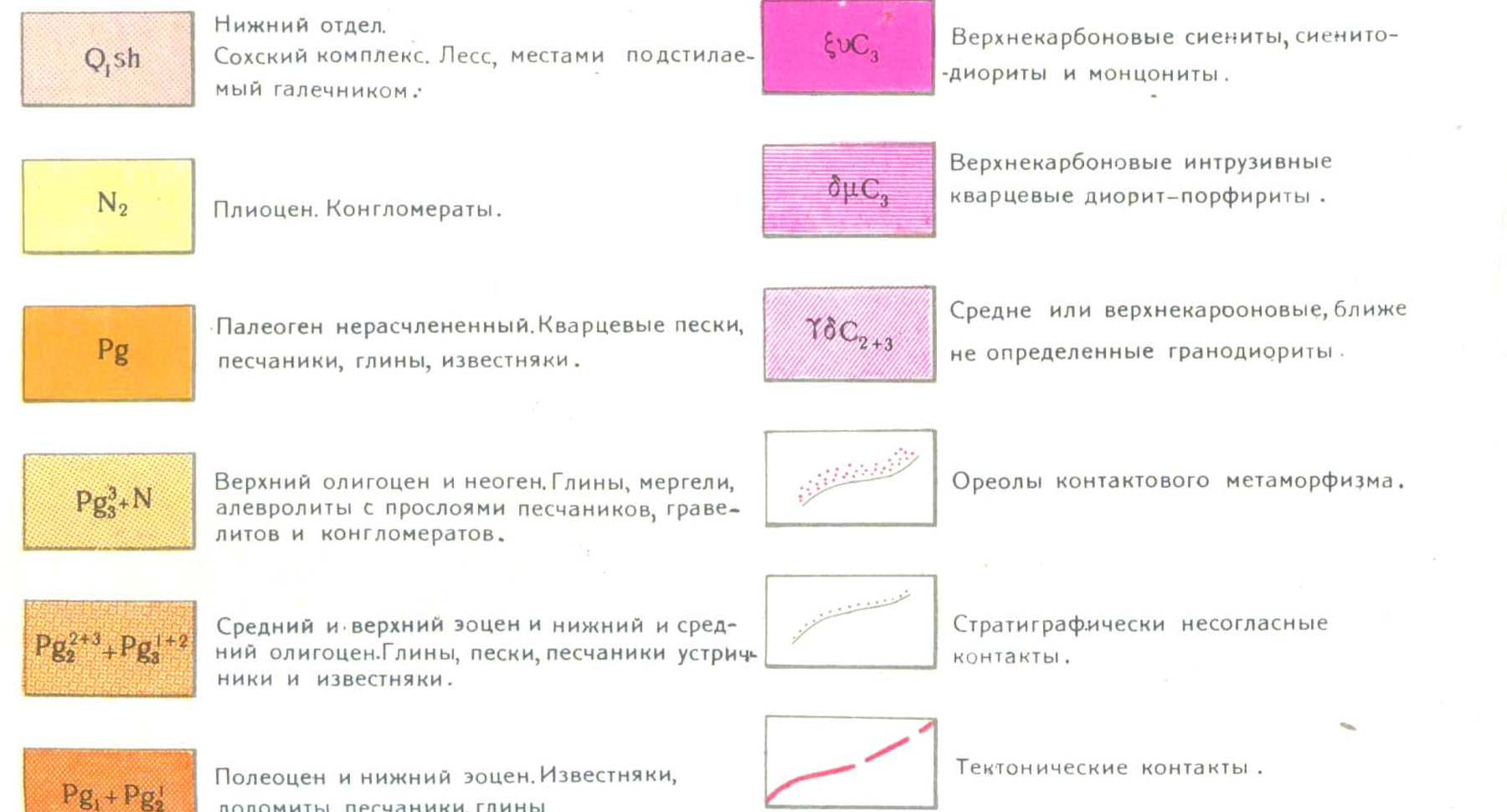
1956 map, original legend and a GPS overlay are now embedded below.
MARBLE CANYON · WESTERN TIAN SHAN
Reading Chimgan’s geological history through your photographs, fossils and published maps.
Read the findings ↓01 / CHIMGAN
The shell-bearing slabs are most likely Eocene marine limestone. The new evidence no longer supports presenting Eocene and Carboniferous as equally likely explanations.
A narrower working interpretation is middle Eocene, roughly 48–38 million years old, if the slabs belong to the locally documented Turkestan beds. This is a geological correlation, not a measured date for your specimens. [17] [18]
What changed: the original K‑42‑XXII sheet places the photo cluster beside a Paleogene belt and younger cover. More decisively, Belenky and Mirkamalova’s 1965 monograph explicitly records oyster-bearing limestone and marl at Beldersay, in the Turkestan beds. [15] [17]
The precise contact and fossil species remain unconfirmed. Most close-up camera points plot at or just outside the mapped Paleogene boundary, on the younger-cover side. At 1:200,000 this prevents a confident bed-by-bed assignment; it does not make the much older mountain limestone an equally supported explanation.
1956 map, original legend and a GPS overlay are now embedded below.
Author Z. P. Artemova; archive number 11972. The catalogue entry is available, but the full text has not been obtained.
Printed page 58 of the 1965 monograph records the oyster Gryphaea romanovskyi in local limestone and marl.
Revision 3 · 18 October 2026. The map evidence and local fossil description replace the earlier unresolved two-age comparison.
02 / CHIMGAN
First a seabed, then an ancient mountain belt, later an eroded landscape—and finally a mountain raised again.
Shells, skeletal fragments and carbonate mud built thick deposits. The Russian district guide assigns much of Greater Chimgan’s limestone to the middle and upper Visean, within the early Carboniferous period. “About 340 million years” is a useful rounded age, not a date measured from your specimens. [1]
Ocean closure and the joining of crustal blocks built the older Tian Shan. Sediments were folded and faulted; magma rose and solidified as granite. Heat could partly recrystallise limestone into marble-like rock. This was a long sequence, not one eruption or one uplift event. [2]
Much of the old relief wore away. Younger deposits accumulated on the eroded foundation. In the Chimgan–Charvak district, the guide records continental Cretaceous red beds and narrow bands of Eocene marine limestone and marl—a mixture of lime and clay. These younger beds need not have the age of the mountain’s main limestone. [1]
The far-reaching effects of India’s collision with Eurasia helped reactivate old weaknesses in the Tian Shan. Different blocks rose by different amounts, while rivers removed rock. The modern mountain is much younger than many of the rocks inside it. Cooling studies also record earlier episodes: Chimgan does not have a single, simple “uplift birthday”. [3]
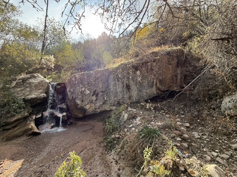
Water exploits cracks, dissolves limestone and moves abrasive sand and pebbles. This makes narrow channels, hollows and waterfall steps. These landforms are younger than the rock; their precise age has not been determined here.
The district guide describes Greater Chimgan as an upward-arched fold beside the downward fold of Lesser Chimgan. It records an elevated northeastern limestone block, a lower southwestern part with volcanic rocks, and a major fault along the northwest. A thrust is a fault where compression pushes one rock mass over another. These regional structures explain why neighbouring slopes can expose quite different rocks. They do not prove that any particular crack in your photograph is a major fault. [1]
A further Russian source adds useful detail: Sadykova’s 2022 monograph includes the Chimgan granite body in the Arashan complex of Permian intrusions. This reinforces the picture of older limestone alongside later magma bodies. It is a classification of the granite, not a date for the shell bed. [14]
03 / CHIMGAN
The numbered points below are the GPS positions stored in your photographs. They locate the camera, not necessarily the distant rock being photographed. No connecting line is shown because the seven images do not establish a complete walking track.
Loading OpenStreetMap background…
Numbers match the gallery. Orange point 2 is approximately 1 km west of the nearby close-up photographs; its metadata is retained but needs checking. The dashed line at 70°E is a geological map-sheet boundary, not a fault. Basemap: © OpenStreetMap contributors. Open a larger map ↗
They lie west of 70°E, at the sheet’s eastern edge. Greater Chimgan’s summit is east of that boundary on the neighbouring sheet. The original scan and a georeferenced digital copy have now been obtained; their geological interpretation follows below.
| Photo | Latitude °N | Longitude °E |
|---|---|---|
| 1 | 41.509597 | 69.989472 |
| 2 | 41.507847 | 69.977731 |
| 3 | 41.508628 | 69.991067 |
| 4 | 41.507778 | 69.992797 |
| 5 | 41.507181 | 69.993789 |
| 6 | 41.499089 | 69.997842 |
| 7 | 41.505372 | 69.996650 |
Coordinates are shown to six decimal places to preserve the original metadata, not to imply centimetre accuracy. No reliable GPS accuracy estimate accompanies them. Photo 6 is a distant view; photo 7 is more useful for checking the slab’s local setting.
04 / CHIMGAN
Uzbekistan’s public geological archive now provides specific document records. These are catalogue descriptions, not downloaded reports. They strengthen the local Eocene interpretation but do not yet confirm that your individual slab belongs to the Turkestan beds.
A naming trap: the younger “Beldersay formation” in these survey summaries is not a synonym for the oyster-bearing Turkestan beds. It is listed among younger continental deposits.
Access status: no full-text or map-download control was present on the public document pages inspected. The portal’s services list directs geological-information provision to the Centre for Subsoil Use through my.gov.uz; this does not establish that these historical scans can be obtained immediately or without conditions. No archive request has been submitted.
What would count as confirmation? A detailed map placing the slab in a named Turkestan unit, backed by its local section or fossil list. Until those pages and plates are read, “likely Eocene; possibly Turkestan beds” remains the defensible wording.
The original 1:200,000 sheet is now available. Its local pattern matters more for this question than the broad regional maps.
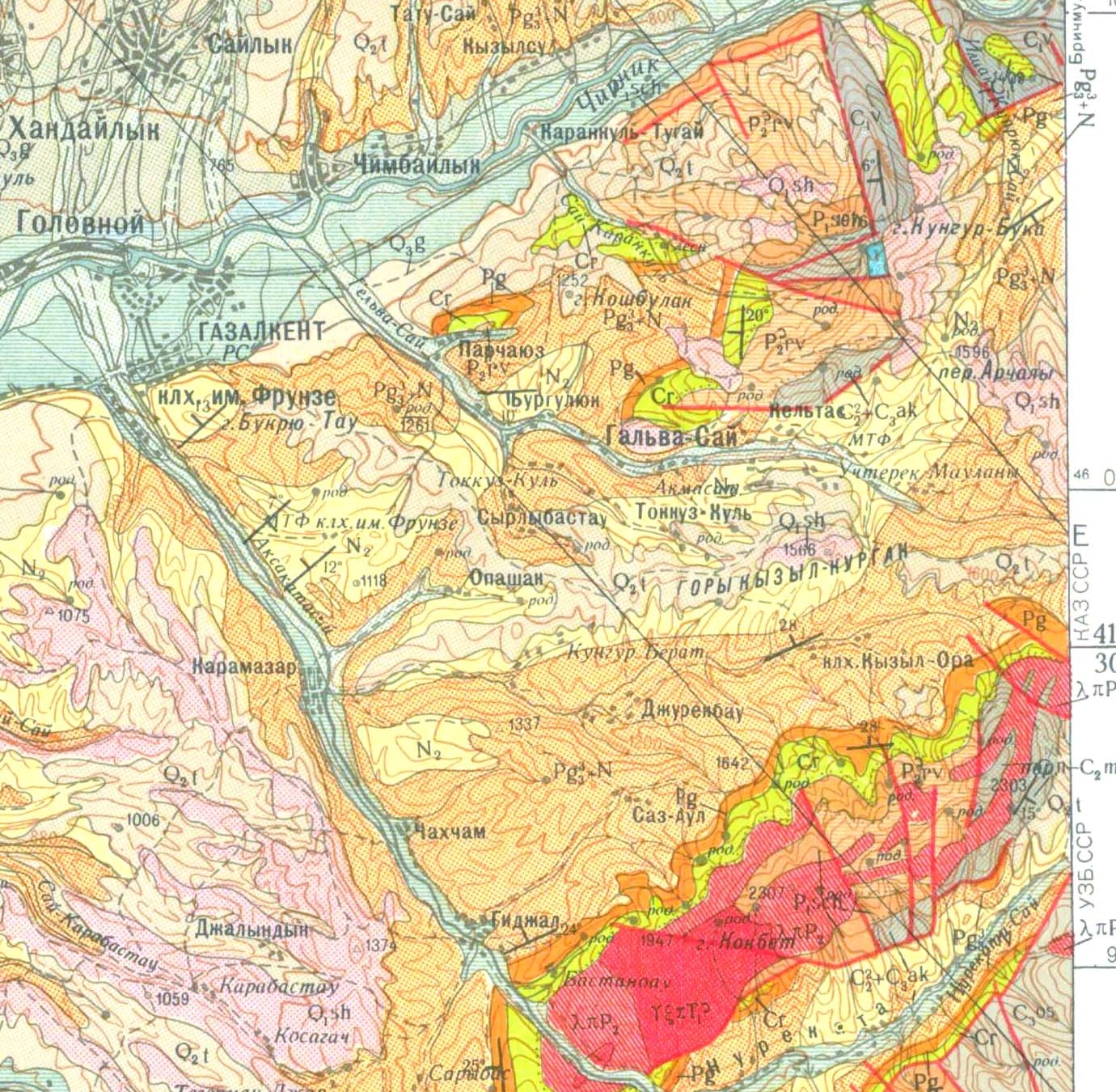
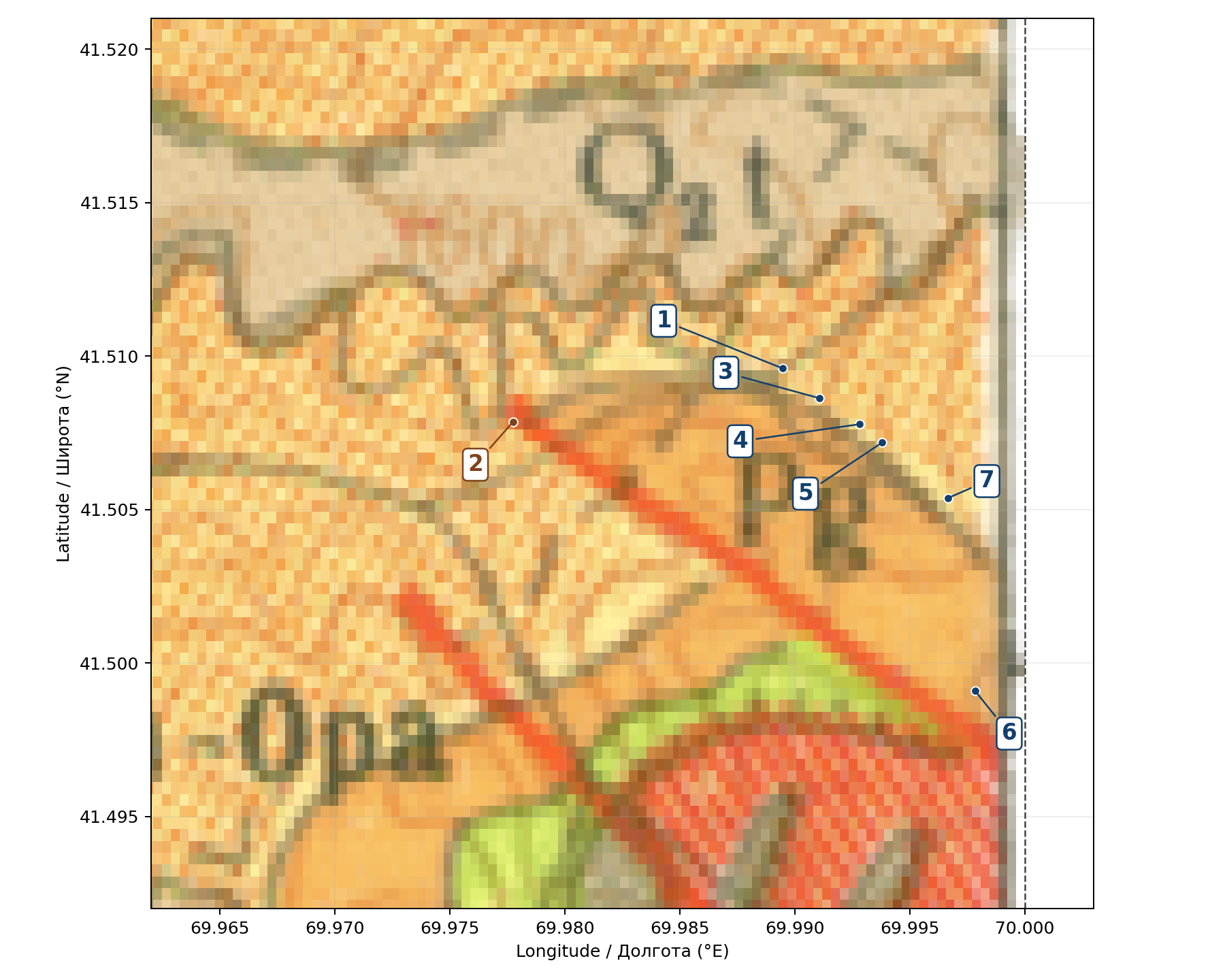
Plain orange, Pg: Paleogene rocks, not divided into smaller age units here; the legend includes limestone. Dotted yellow-orange, Pg₃³ + N: upper Oligocene and Neogene cover, including clay, marl, siltstone, sandstone, gravelly rock and conglomerate. Red lines: faults, where rock masses meet after movement.
Photos 1, 3, 4, 5 and 7 lie along the northern edge of the plain-orange belt, mostly just on the younger-cover side in this digital overlay. Photo 6’s camera plots inside the plain-orange belt, but it looks at a distant slab. Point 2 lies farther west. None of these positions is cleanly centred in a mapped Carboniferous limestone polygon.
This is a boundary problem, not an exact identification of every exposed bed. One millimetre on the printed map represents 200 metres. Narrow limestone beds may be omitted, and the old survey, modern digital positioning and camera coordinates introduce additional uncertainty. The TIFF comes without a published accuracy assessment.
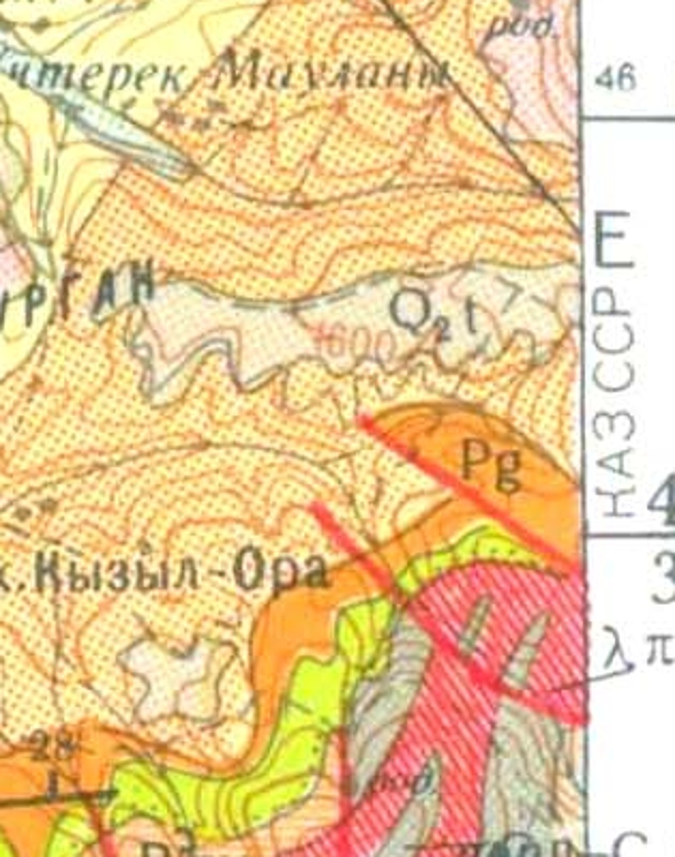
Z. P. Artemova, 1961; RGF/TGF 11972. The Kazakhstan register lists Геологическая карта ССР м-ба 1:200000. Лист К-42-XXII. Серия Приташкентская. Объяснительная записка. The public item page confirms the author, year and number. I found no downloadable copy of the text. This is now a specific archival document to obtain, rather than an unidentified missing source. [16]
Date check: the scan bears 1956, whereas the USGS bibliography lists this sheet under 1958. The explanatory notes are catalogued as 1961. These dates are reported separately; their relationship has not been established. [13]
These are extracts from the publications, with their scientific content preserved. Click a figure to enlarge it; the original source remains linked in the caption. Their scale and purpose determine what they can tell us.
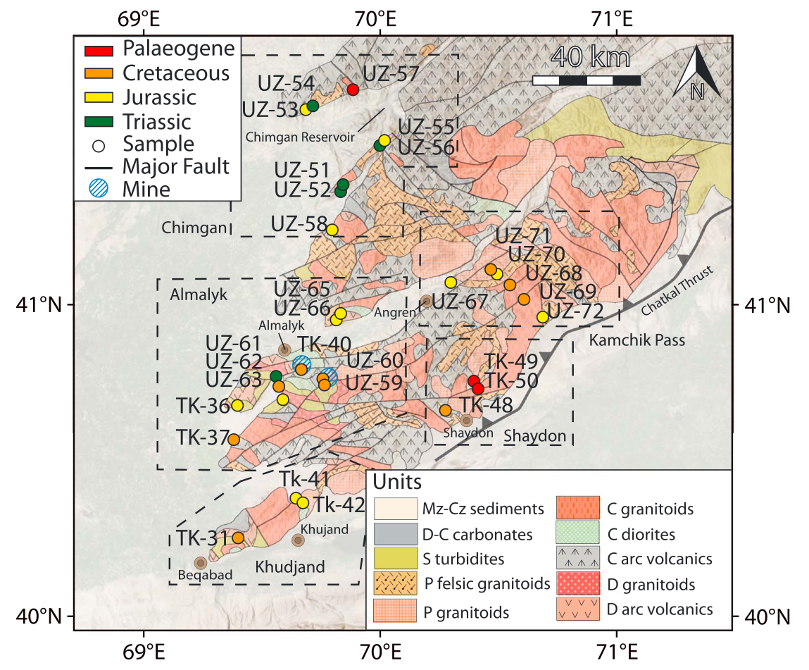
Grey: Devonian–Carboniferous limestone and related carbonate rocks. Orange/pink patterned areas: different granite groups. Other patterned areas show volcanic rocks; pale cream combines much younger sediments. The coloured dots are rock samples whose cooling history was studied—they are not fossil ages.
Your photographs lie near 70°E, 41.5°N, close to samples UZ55–UZ56 and the western edge of the mountain geology. Labels and sample symbols obscure some boundaries there. This regional map supports a complex setting, but it cannot distinguish the particular pale slab from a narrow younger sedimentary belt. The label “Chimgan” farther southwest should not be treated as a precise marker for your hike.
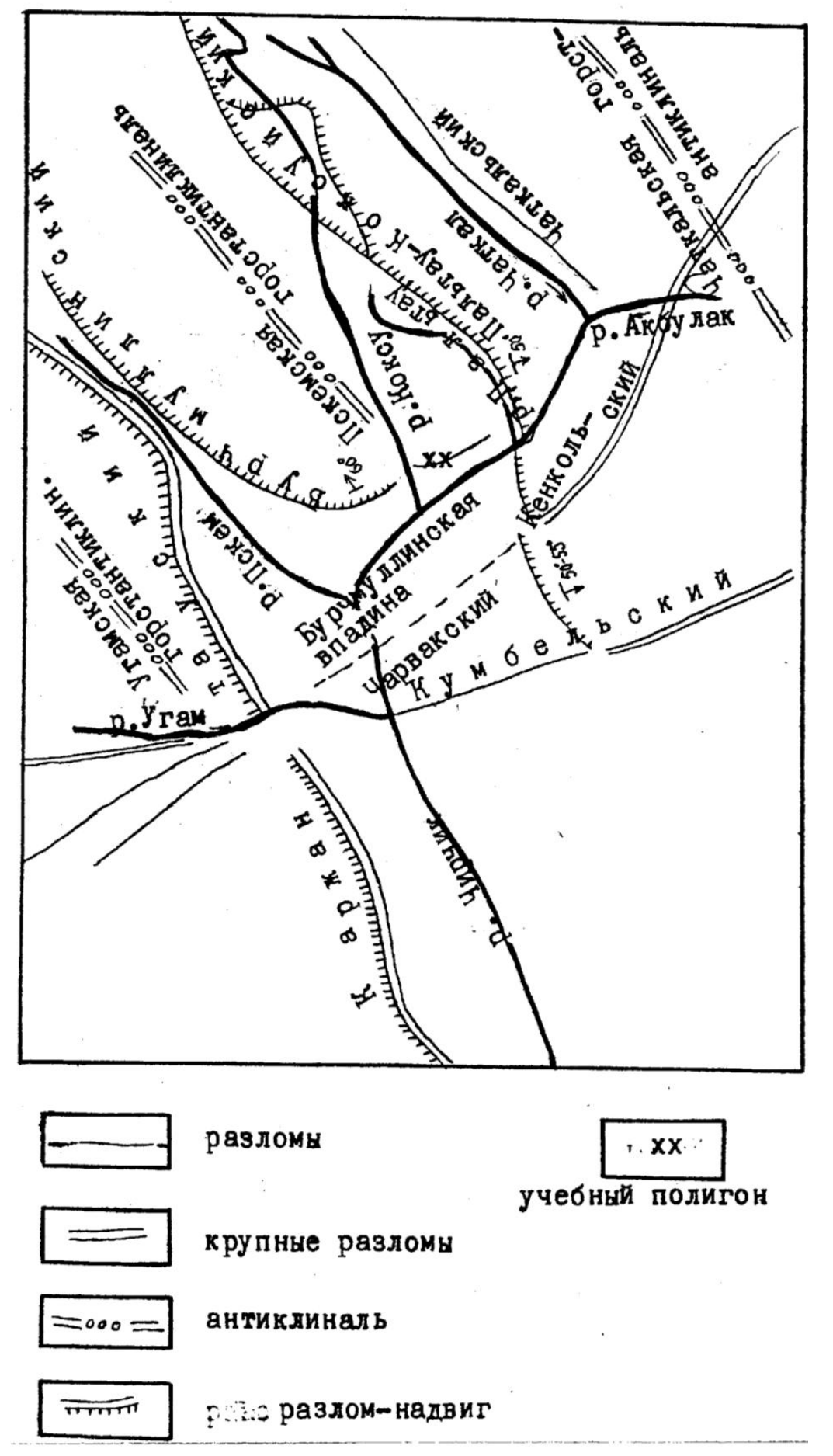
Reading the Russian legend: разломы = faults; крупные разломы = major faults; антиклиналь = an upward-arched fold; разлом-надвиг = a thrust fault; учебный полигон = the teaching area. Toothed lines show thrusts. This is a diagram of regional structure, without a coordinate grid or detailed rock-age polygons. It must not be stretched into a precise GPS overlay.
05 / CHIMGAN
Eocene is now the best-supported interpretation. Middle Eocene, roughly 48–38 million years ago, is a useful narrower hypothesis if the slabs are part of the local Turkestan beds. It is not yet a confirmed age interval for this exact outcrop.
Belenky and Mirkamalova (1965), printed page 58, name Beldersay among localities where the Turkestan beds consist of limestone and marl with Gryphaea romanovskyi, an oyster. This is a description of the local district, not an analogy borrowed from distant Fergana. It does not give coordinates for your individual slab. [17]
On page 59, the authors discuss disagreement over the age of the Turkestan beds and provisionally place them in the late Eocene. Later work places the formation in the middle Eocene: a 2025 study of Fergana identifies its studied Turkestan sequence as Lutetian. An old regional layer name cannot automatically be converted into a precise modern numerical date at another locality. [17] [18]
| Conclusion | Evidence and confidence |
|---|---|
| Likely Eocene About 56–34 million years | Best-supported synthesis of the local oyster-bearing limestone description and the younger-rock setting on the original map. Still an inferred assignment to the photographed bed. |
| Possible middle Eocene Broadly 48–38 million years | Conditional on correlation with the Turkestan beds and their later age interpretation. The strongest narrower working hypothesis; no exact stage or numerical date demonstrated at Marble Canyon. |
| Carboniferous, around 340 million years | Relevant to the mountain’s older limestone, but no longer an equally supported interpretation for these slabs. The map does not place the photo cluster within that limestone, and a local Eocene oyster-bearing sequence is documented. |
The outstanding question is which part of the young marine sequence is exposed beside the mapped younger cover. The next decisive evidence would be the local section in archive item 11972, a larger-scale original survey, or a field trace from the shell bed across the mapped boundary. Identifying an intact oyster would help test a Turkestan-bed correlation. An exact “40-million-year-old” label would still be premature.
06 / CHIMGAN
A shell bank records life and sediment accumulation in water. If the shells are oysters, a shallow sea or coastal setting is likely. But a bank may contain shells that lived there or shells concentrated by waves; the photographs alone do not distinguish the two.
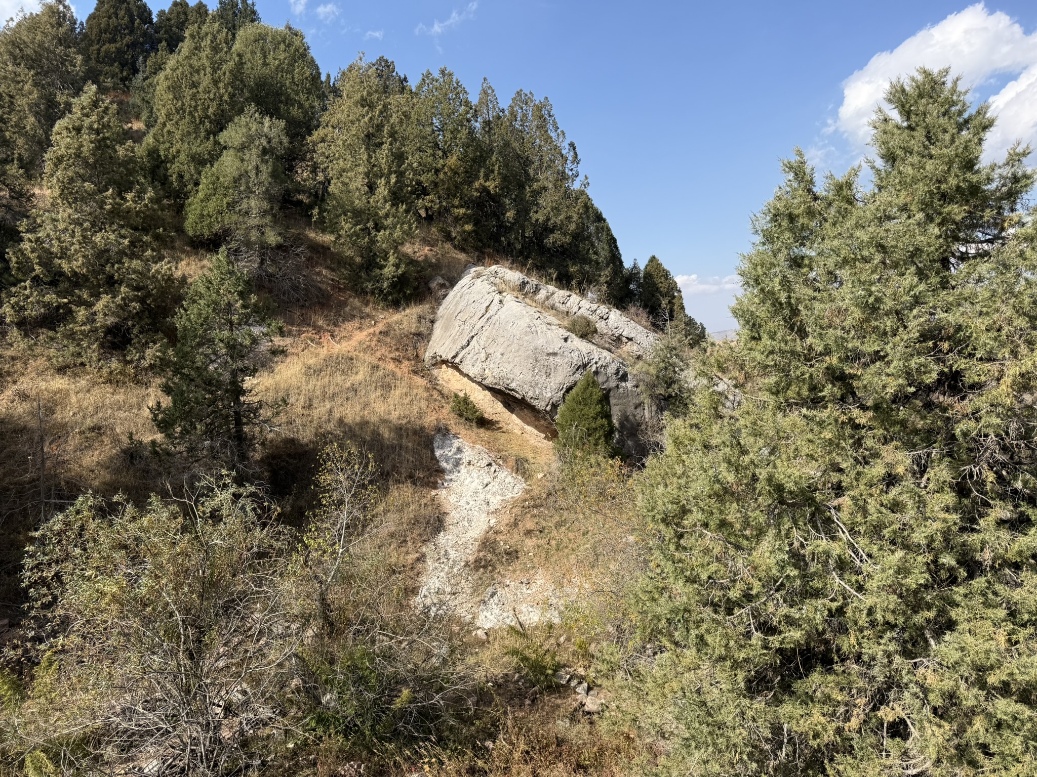
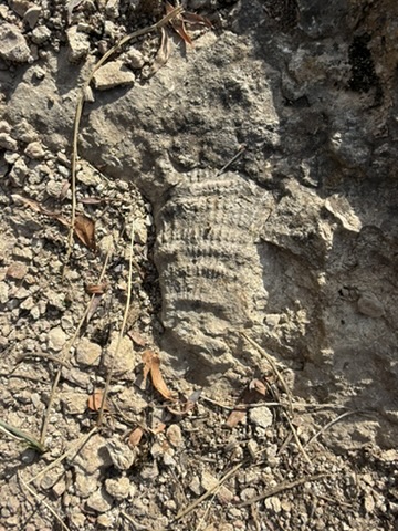
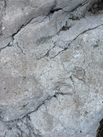
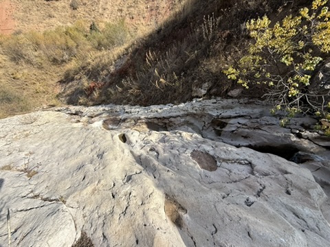
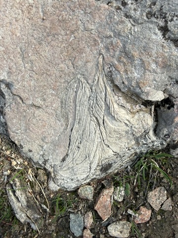
Photo 4 shows thick, curved layers that are compatible with a shell section. Photo 2 has possible shell outlines. Photo 1 contains a ribbed fragment that is not sufficiently diagnostic to name. No species identification is made here. Ancient seas also supported brachiopods—two-valved animals distinct from oysters—and corals, both relevant when considering old limestone. [11]
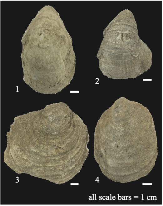
The Fergana paper illustrates several oyster groups and combines fossils, measured layers and chemical measurements to interpret an Early–Middle Eocene marine succession. Its importance here is methodological: well-preserved shells plus their rock sequence can provide an age. It is not evidence that a similar-looking shell at Chimgan has the same age.
07 / CHIMGAN
Continental interiors have not always been far from the sea. During the Eocene, the proto-Paratethys—a broad inland-reaching marine system connected toward the west—extended into several Central Asian basins. Its eastern shores withdrew in stages.
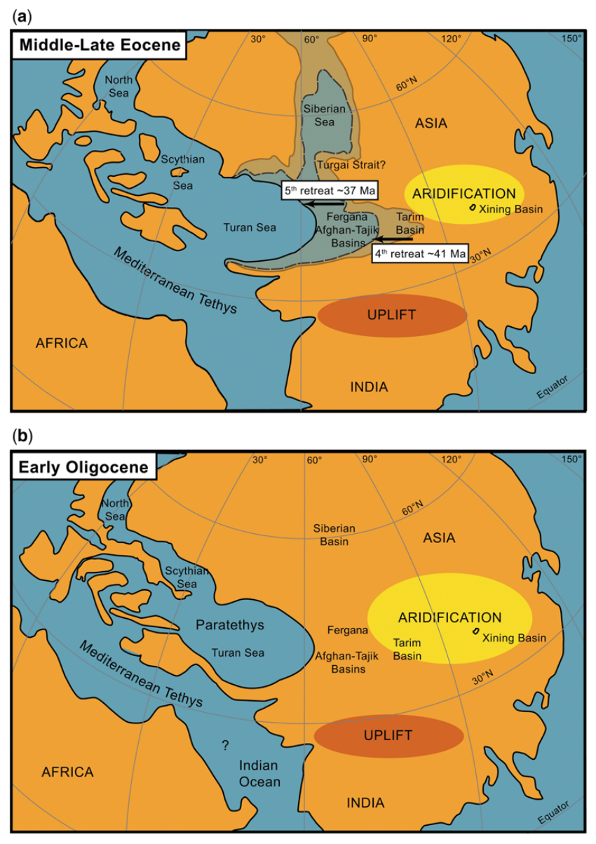
The upper panel reconstructs middle–late Eocene geography; the lower shows the early Oligocene. The authors used plate positions at 38 and 32 million years ago and explicitly describe the coastlines as approximate. These are regional reconstructions, not a map of a proven shoreline at your fossil location.
Sea retreat, increasing distance from moisture sources and later mountain barriers contributed to Central Asia’s drying. Studies of chemical changes through oyster shells also find strong seasonal differences in ancient climate. Thus “marine fossils in a dry landscape” is not a contradiction: both geography and climate changed over millions of years.
08 / CHIMGAN
Tilted and split is a reasonable reading of the photographs. Displaced along a fault remains a hypothesis.
A resistant limestone layer can be tilted during folding, then divided by cracks. Erosion of softer material beneath it can leave projecting slabs; some blocks may later slide or rotate downslope. Those processes can act together.
To demonstrate fault displacement, we would need a recognisable layer or vein cut and shifted on opposite sides of the same fracture. That marker is not visible clearly enough here. Equally, the red material might be weathered rock or soil; it cannot safely be labelled a particular Cretaceous or Paleogene formation from its colour alone.
“Marble Canyon” is a place name, not a rock test. Limestone becomes marble when its crystals grow again under heat and pressure. Partly changed limestone can retain fossils, but a pale, polished streambed is not by itself proof of marble.
09 / CHIMGAN
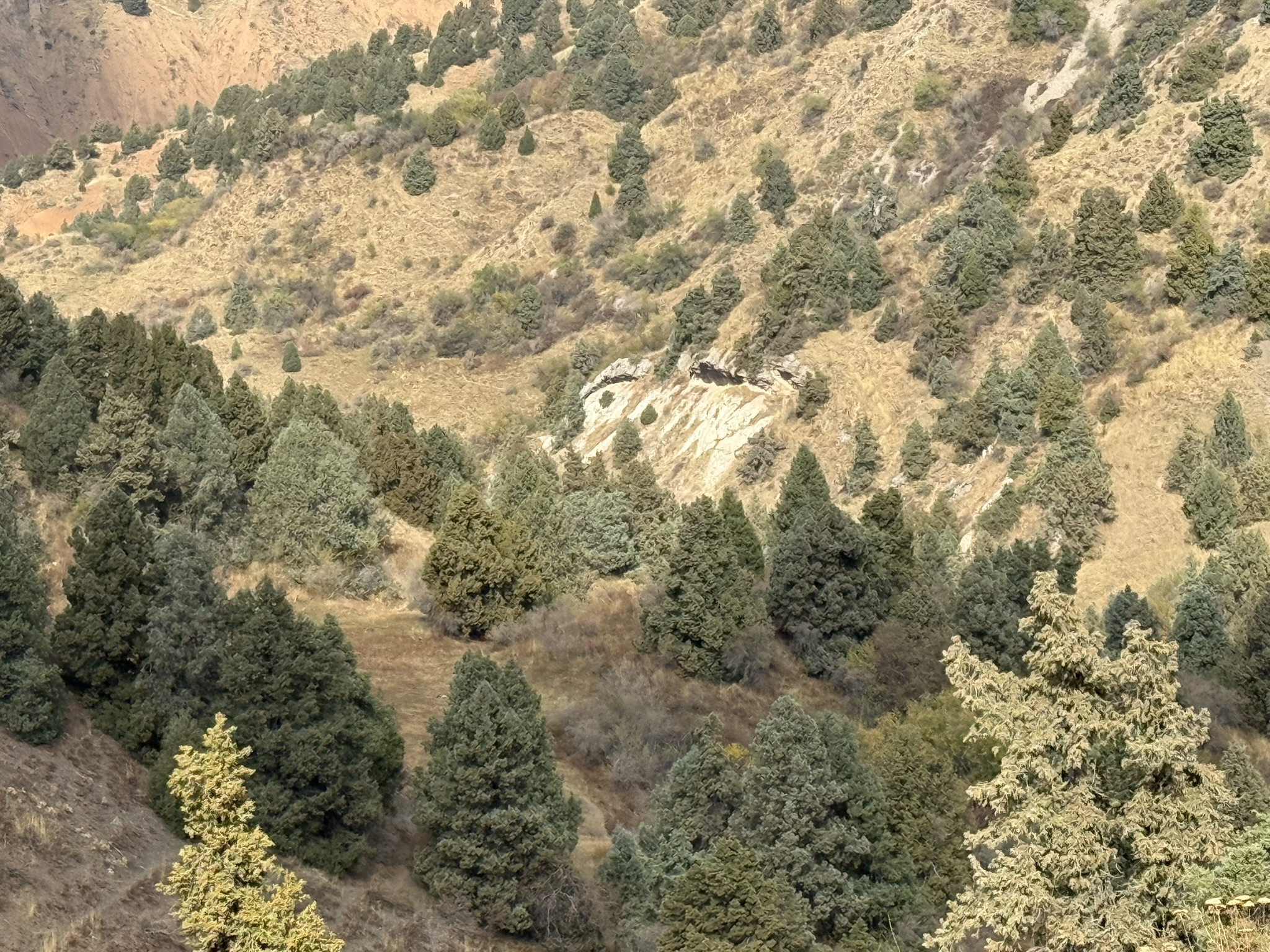
The original seven photographs are retained. Captions separate visible features from interpretation; numbers match the interactive map. Select any image to enlarge it.
10 / CHIMGAN
This revision is based on the original map, its archive catalogue and a newly obtained Russian monograph with a named Beldersay fossil occurrence. Searches included Cyrillic and Latin sheet numbers, Приташкентская серия, Артемова, Бельдер-Сай and the local rock-unit names. Searching the GeoKniga catalogue directly and Kazakhstan’s geological-report register produced evidence missed by general web searches.
Read: original map and legend; relevant full-text pages of the 1965 monograph. Located but not read: explanatory notes, archive item 11972. Abstract only: the 2025 Fergana age comparison. The original files and mapping method are retained with the report’s research material.
Read in full. Printed pp. 11–12: limestone and younger cover; pp. 20–24, Figs 5–6: structure. A district teaching guide, not a measured section of your shell bed.
Regional reconstruction and ages of igneous rocks; author-uploaded full text consulted. Does not date the photographed limestone.
Full paper and Figure 2 geological map inspected. Table 1 contains nearby samples UZ55 and UZ56. Cooling ages are not sedimentary ages.
Publisher abstract consulted; full publisher text unavailable. Used only as a nearby regional analogue, not as proof of a Marble Canyon contact.
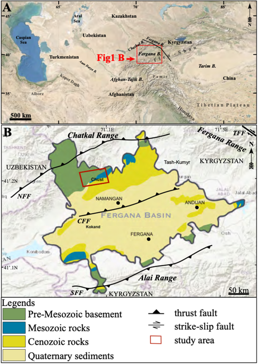
Full PDF inspected. Figures 1 and 7 reproduced under CC BY 4.0; outer page text cropped, scientific panels unchanged. Figure 1B was modified by these authors from their reference 4. Their sites are near Chust, not Chimgan.
Full text consulted, especially Figure 8 and discussion. Correlation across several basins; the authors explicitly describe reconstructed coastlines as approximate.
Repository abstract consulted. Regional palaeoclimate evidence from Tarim and Alai, not a chemical analysis of the supplied fossils.
Indexed figure caption and surrounding Uzbek text retrieved; full PDF could not be fetched and title/authorship could not be verified. Discovery lead only: not used to assign any local rock unit or age.
Mineral resurslar instituti: Yutuqlar (Achievements).
Indexed institutional statement reports Uzbek/Russian national digital maps at 1:1,000,000 and a Chatkal–Kurama predictive metallogenic map at 1:200,000. These map files were not obtained; a mineral-potential map is not automatically a detailed bedrock map.
US National Park Service. Limestone FAQ and solution-cave resources.
General limestone-to-marble and carbonate-weathering context; no local age evidence.
Delaware Geological Survey. Lamp shells (Phylum Brachiopoda).
Used to explain why two-valved fossils should not all be called oysters.
User reports that the fossil banks occur in the pictured pale slab formation. Original camera metadata read; no measured bedding, specimen scale, thin section or surveyed outcrop boundary supplied.
Bibliographic cross-check. This USGS list dates the sheet 1958; the scan retrieved for this revision bears 1956. See the actual map under reference 15.
Author-uploaded full text, pp. 92–94: Chimgan is listed among the Arashan granite intrusions. Dates quoted for the Maidantal massif are not direct dates for Chimgan.
Original JPEG and accompanying georeferenced TIFF downloaded and examined. The TIFF is a later digital derivative; its positioning accuracy is not documented. Printed legend, local contacts and sheet coordinates checked.
Exact title located in the Kazakhstan geological-report register; item page confirms author, 1961 and archive number 11972. Catalogue record only: no downloadable text found. Not treated as a source whose geological contents were read.
Full scanned monograph obtained. Printed p. 21: Beldersay mapping in 1955–56; pp. 55–56: Alay shell-bearing limestone; p. 58: Beldersay explicitly included among Turkestan limestone/marl localities with Gryphaea romanovskyi; p. 59: provisional late-Eocene assignment and discussion of a middle-Eocene alternative. PDF pages are two higher than printed pages.
Publisher-indexed abstract read; full text not obtained. Reports Turkestan Formation as Lutetian and Rishtan Formation as Bartonian at the studied Fergana locality. Supports updated regional correlation, not a direct date for Marble Canyon.
Uzbekistan State Geological Fund catalogue and abstract read. Full text and plates not obtained. Relationship to the separately catalogued 1961 notes (11972) is not established.
Catalogue and abstract read. Sheet designation includes the calculated 1:25,000 sheet of the close-up photographs, K-42-92-Б-г. Abstract describes fossil-bearing Paleocene–lower Oligocene strata, 28.5 m; it does not identify the photographed bed as Turkestan. Map plates not obtained.
Catalogue abstract explicitly includes Beldersay, Aksakata and Tashsay, re-examined fossil collections and age-correlation charts. The actual Beldersay chart and age conclusions were not available in the public entry.
Catalogue abstract describes 45 m of Eocene limestone, gravelly rock, sandstone and clay. This sheet contains camera position 6, not necessarily the distant outcrop photographed from it. “Middle division (Eocene)” refers to the middle division of the Paleogene, not specifically middle Eocene.
Publication titles and labels within published figures retain their original languages. Photographs: Tobias Siegfried, 18 October 2026. Public copies retain the original pixels; metadata is removed and coordinates are presented explicitly.